
Alaska Motorcycle Trip 2016
- Aug 10, 2016
- 16 min read
[if !mso]> <style> v\:* {behavior:url(#default#VML);} o\:* {behavior:url(#default#VML);} w\:* {behavior:url(#default#VML);} .shape {behavior:url(#default#VML);} </style> <![endif]
My Alaska motorcycle trip actually began in 2015 after riding the Utah Backcountry Discovery Route. I had previously ridden dual-sport motorcycles mostly on unpaved roads from Tennessee to Arkansas and then from Arkansas to Utah on the Trans-America Trail. I had also ridden over the mountain passes on sections of the Colorado Backcountry Discovery Route and the grueling Arizona Backcountry Discovery Route in 2014. Plus, I had taken a road trip on my last bike, a Triumph Tiger 800XC to Asheville, NC and then down to Key West, Florida.

When one trip ends the planning begins for the next adventure. Alaska had been on my “bucket list” for many years. Would the calendar allow an extended trip in 2016?
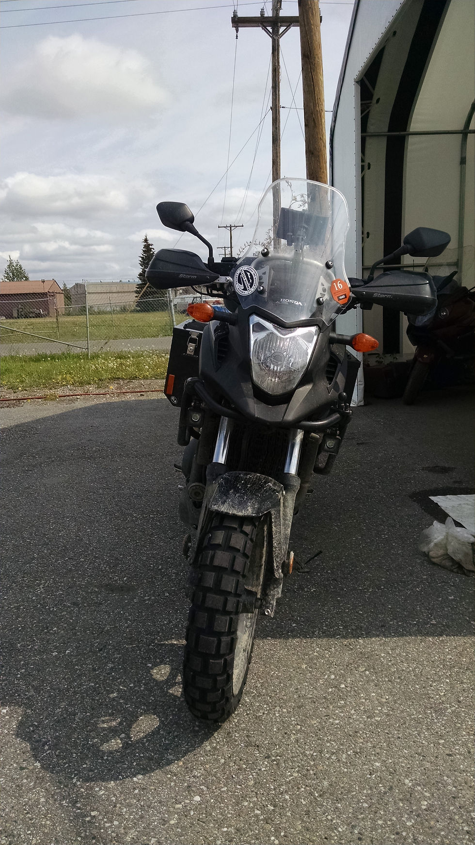
My first preparation would be building the perfect dual-sport motorcycle. If I was going to ride to Alaska, I wanted to include many miles of unpaved roads to some of the remote locations that I had read about. That meant a mid-weight bike with good fuel economy. I am not a fan of the monster 1000cc and 1200cc bikes that weigh over 800 pounds. I was going to be making a solo ride so I needed a bike I could handle even if no one was around to lend a hand. But the trip to Alaska and back includes several thousand miles of paved roads so the bike also had to be powerful and comfortable for long, long days.
After much comparison shopping, I decided on the Honda NC700XD. Like all dual-sport motorcycles, this bike was a compromise. At 670cc it was on the low end of the “adventure” category. But this smaller engine also delivered outstanding fuel economy over 60mpg! Instead of the tall 21-inch motocross front wheel I had on my previous Triumph and Yamaha, the Honda had 17-inch wheels front and rear. The larger front tire is a big advantage in rough terrain, but I only wanted a bike for riding gravel and dirt roads, not motocross off-roading. Plus, unlike most dirt bikes, the Honda had tubeless tires that allowed for faster fixes of simple punctures without even removing the wheels from the bike.
I also opted for the DCT model, or Dual Clutch Transmission version of the NC700. This new transmission uses two clutch plates to instantly engage the correct gear at the exact rpm. No rev and pause and shift like a conventional clutch, or even an electric shift. The shifting is precise and smooth and perfectly efficient. Honda is simply providing what 98% of auto and truck owners consider standard: an automatic transmission.

Next, I outfitted the new stock Honda with the necessary accessories to make the journey:
Honda extended windshield
Honda center stand
Barkbuster hand guards
Oxford heated grips
Hepco & Becker engine guard
LED driving lights
SW Motech quick-release pannier brackets. To these I bolted a set of Tusk small aluminum panniers. The low exhaust placed the panniers close to the bike for minimal wind resistance.
SW Motech rear rack and Bestem plastic top box with LED brake light
Cortech quick-release tank bag over the Honda front trunk
Pyramid front Fenda Extenda
AltRider aluminum radiator guard
Blue Sea accessory fuse block for the driving lights, heated grips, Garmin Nuvi GPS, a 12-volt outlet, and 2 SAE outlets for a battery tender and for my heated 12-volt vest.
I also added two carriers under the rear box to carry MSR fuel bottles. The 500ml fuel bottles served as fuel for my Coleman camp stove and emergency fuel for the bike.
I carried my sleeping bag, tent, sleeping pad and a compact cot in the waterproof duffel that I secured across the pillion seat and the tops of the pannier boxes. On top of the duffel I had a camelback water container in a cargo net that also provided a convenient place to stash my jacket as the day warmed up. In every other respect, the Honda was stock - no modifications to the engine or exhaust.
In April I loaded up the bike and took off on a three-day, 750-mile ride around NW Arkansas. Everything worked perfectly. After a little reorganization of the packing list and some fine-tuning of the load distribution, I was ready for Alaska!
I began my 2016 Alaska adventure on June 1st. For the first two days I trailered my Honda NC700XD to my Cousin’s home in Mountain Home, Idaho from Arkansas. This cut off 1,725 miles coming and going from Idaho, and at least 6 days of riding across the hot and windy plains of the U.S.
On June 4th I left Mt. Home and rode west to Boise and then turned north up the panhandle of Idaho, crossing the border into British Columbia at Eastport. I found a spot to camp for the night. Total distance was 559 miles on Day 1.


Riding north through the panhandle of Idaho
Day 2 began with a ride up Hwy 95 in BC to Kootenay National Park, and then NW along the Ice Fields Parkway in Alberta past Lake Louise to Jasper. You could have stopped every mile for a photo.


The mountains rose up on all sides. Glaciers hung in the valleys, waterfalls fell from the cliffs. And there were sheep, deer, bear, and elk visible from the road. Riding alone, I couldn’t stop and tour the many sights that required parking and walking. So I stopped, took a few photos and moved on. After supper in Jasper, I headed NE toward Hinton, then NW toward Grand Cache for a campsite. I rode 510 miles on Day 2.

Day Two Campsite, “Free camping” along the highway
Day 3 the route continued into Grand Prairie, Alberta and then west on Hwy 43 to Dawson Creek, BC - the official start of the Alaska Highway.

Mile Zero on the Alaska Highway, Dawson Creek, BC
The countryside in central BC reminded me a lot of northern Wisconsin where I lived for many years. The difference was instead of whitetail deer there were now mule deer, grizzly bears and even a dead moose along the road. After lunch I continued NW on Hwy 97 and finished the day in Fort Nelson, BC. Black clouds followed me into town and I quickly found a motel for a shower and some laundry. This was a total of 502 miles on Day 3.
Day 4 continued west to Toad River for fuel. I had a comfortable range of 200 miles on the 3.7 gallon tank. But often the fuel stops were about 150 miles apart meaning that couldn’t skip a stop and make it 300 miles before refueling. That was OK; I needed an excuse to stop and stretch every few hours anyway. Most of the rural gas “stations” were simply one fuel pump. There were no convenience stores outside of the larger towns.

The highway continued to Watson Lake and the famous "Signpost Forest". This is a collection of thousands of street signs and city signs from around the world. The display originated with the construction crews who were building the Alaska Highway and has continued to grow ever since.


Sign Post Forest in Watson Lake, Yukon Territory
After refueling again, I rode on Hwy 1 to Teslin for a campsite on Day 4. It was on this last leg that crossed back over the BC border that I saw 8 bison right on the mowed shoulder of the Alaska Highway. I had also seen 5 black bears during the day. A total of 492 miles on Day 4.

Wild Bison along the Alaska Highway
Day 5 started out nice with a fast ride into Whitehorse, Yukon. After coffee and a doughnut at Tim Horton's and fuel for the Honda, I continued west on the long route towards Alaska.

Whitehorse, Yukon Territory on the Yukon River
The afternoon weather turned nasty - cold, rainy, and very windy. It was a long cold slog against a tiring cross wind in a driving rain to Destruction Bay. Then another 136 miles brought me to the US border and crossing into Alaska.


The U.S. border crossing from Canada into Alaska
Another 93 miles later, I arrived in Tok, AK. I had ridden 511 miles on Day 5. The total mileage was 2,554 miles in the first 5 days.
On Day 6 I got started early and rode the 204 miles into Fairbanks where the Honda dealer was waiting with a new set of tires to replace the stock highway treads. I had a Continental TKC80 knobby installed on the front and a Heidenau K78 installed on the rear. Along with an oil change I was ready for the unpaved roads ahead.
A new set of “shoes” on the Honda!
At every stop someone asked about the Honda. It had performed flawlessly. Plenty of power and great economy. Not even the Honda dealer in Fairbanks knew how great a motorcycle the NC700 was. They didn’t even have a single one in stock! They did have lots of Harleys and BMW’s on display. But I could buy THREE Hondas for the price of a BMW GS or Harley! In terms of operating costs, the Honda had them all beat.
I had originally planned on staying in Fairbanks that night, but since it was only early afternoon I grabbed some lunch and started north for the Dalton Highway. First, I stopped at a parts store and bought a 1-gallon fuel can. Full of fuel and now with a 1-gallon reserve I headed north.
It is 84 miles of paved road from Fairbanks to the start of the Dalton Highway, also known as the “haul road”. (Some of the paved roads were rougher than the dirt roads due to frost heaves and broken surfaces.) After a stop for a photo, I turned north on the unpaved road headed for the Yukon River camp and gas, another 56 miles north.

The end of the pavement and the start of the James Dalton Highway

The bridge over the Yukon River, 140 miles north of Fairbanks
After the Yukon River, it is another 59 miles to the Arctic Circle. This is a mandatory photo opportunity. There is a "wayside" and a sign marking the line at 66.33 degrees north. I met a group of tourists from China on rented BMW’s, took a few photos and then continued on to Coldfoot, a total of 259 miles north of Fairbanks and 60 miles north of the Arctic Circle.

The Arctic Circle, about 9:00 pm on June 9, 2016
I arrived in Coldfoot about 10:30 pm. Coldfoot is a truck stop on the haul road. I had supper in the trucker's cafe. The truck stop offers dorm-type rooms across the parking lot for workers on the pipeline, but since the weather was clear, I elected to camp for free alongside the "motel". The picture I took of my camp was at exactly midnight on June 9th. Including the 205 miles from Tok to Fairbanks in the morning, I had logged 477 total miles on Day 6.

My campsite at Coldfoot, taken at 12:00 pm Midnight on June 9, 2016
It was too light and too noisy to get much sleep! Trucks came through all night and construction on the road never ends during the short summer season. So at 4:00 am I got up, repacked the bike and refueled. I was at the cafe when it opened with a breakfast buffet at 5:00 am, and on the road back south about 5:30 am.
I had elected NOT to continue riding the next 240 miles north to Deadhorse. The riding was on the Dalton Highway easy, but boring. I just couldn't get enthused about riding 240 more miles up the Haul Road, only to spend $200 for a room and turn around and ride the same road back the next day. (The two-day schedule is a “best case” assuming that I did not run into rain or slow which would make the road dangerously slippery!) I did sacrifice riding over Atigun Pass and the views of the Brooks Range, but I would see plenty of mountains and over 1,000 miles of dirt roads in the next few days. I was already ahead of my estimated schedule, and cutting off 2 days on the Dalton further advanced my itinerary.

Riding back south on the fast and dry Dalton Highway on June 10, 2016
Day 7 I rode south back to the Yukon River, refueled and then rode to the junction with Alaska Hwy 2 where I turned west toward Manley Hot Springs. From this intersection, the “highway” is a dirt road for the 76 miles to Manley. The riding was great across the ridge tops.


Road construction on the way to Manley Hot Springs
About an hour from Manley I ran into a 10-mile stretch of very rough road construction with jagged rock. Thankfully, I made it through without any flats. I arrived in Manley mid-afternoon. I took a tour of the town, had a drink and a snack at the Roadhouse, gassed up and then headed back towards Fairbanks which was 161 miles away. It was too early to stop for the day. Unfortunately, this meant that I had to retrace my route through the construction zone but I again negotiated the jagged rocks with no punctures to my still new tires. I treated myself to a motel and a soft bed in Fairbanks after a long, mostly off-road ride of 412 miles on Day 7.
Day 8 found me riding south from Fairbanks on Hwy 3 toward Denali. Once again, it started to rain and Denali was not visible from the highway.

Looking west into Denali National Park. Denali is hidden in the distant clouds
After a light lunch in Cantwell, I turned east on the "Denali Highway", a 136-mile unpaved road that goes across to Paxson on Hwy 4. This was some of the best Alaskan scenery yet! I saw one cow moose, then another cow with a calf. The Denali Highway is 136 miles of mountains and lakes and whitewater rivers.


This was my vision of “real Alaska", and it was right here on the Denali Highway!
Soon the riding was complicated with more hard rain and wind. This made the lodge at the Maclaren River a welcome sight. After some hot coffee and fresh banana bread I was ready to complete the leg and look for a campsite near Paxson.

But the higher altitude, cold temperatures and rain made camping unappealing, so I turned south when I reached Paxson towards a break in the clouds in the distance. As I approached Glenallen the weather improved dramatically. I found a great campsite overlooking the Copper River (with fish wheels turning in the river) and the Wrangell Mountains in the distance. Day 8 equaled 359 miles.

Campsite on the Copper River
Day 10 continued south on Hwy 4 to Valdez. Continuous mountains rose ahead and topped out at Thompson Pass. Small photographs can't capture the immensity of the landscape. Waterfalls fell from the snow-covered cliffs.


The view from Thompson Pass. Valdez is far to the south.

Bridal Veil Falls, along Highway 4 north of Valdez
Valdez was somewhat of a disappointment. It is a dock for the cruise ships so there are plenty of tourist shops. I didn’t see anything to hold me longer. Since it was only noon, I headed north to the junction with Hwy 10 and the Edgerton Highway towards McCarthy.

This road is paved for the first 34 miles to Chitina, and then dirt for the next 59 miles into McCarthy. The road crosses an old wooden bridge that once carried the train into McCarthy, about 250 feet above the river below.


The riding was spectacular, despite more driving rain showers.

The foot bridge into McCarthy
The road ends at a parking lot with a foot bridge across the Kennecott River. But motorcycles and atv's can fit on the bridge so I rode directly into town and parked right in front of the Saloon! After a whiskey, a beer and a bison burger I was revived.

Main Street in McCarthy
McCarthy became a ghost town after the neighboring Kennecott mine closed. Today, the mine is open for tours by the Forest Service and McCarthy is an interesting combination of restored buildings, old original buildings, and houses and buildings that are sinking into the woods. Most of the workers are only there for the summer. But about 50 people live year-round in the area. It is this collection of quirky people that is supposed to be the inspiration for the TV show, “Northern Exposure” back in the 1980’s.


I camped just across the foot bridge as a light mist started to fall again. After getting my tent set up, I crawled in and fell asleep. I woke about an hour later to a heavier rain and got out to cover more of my gear. Directly across the river was a solid brown patch. After watching for a while, the patch moved and turned into a cow moose - less than 75 yards away. Day 9 was only 300 miles total.

Campsite on the Kennecott River

A moose about 75 yards away, across the river
Note: McCarthy was supposed to have gas, but the "vendor" decided not to open this year. Luckily I still had my 1-gallon reserve with me and had plenty of gas to ride back the 80+ miles to the store at Kenny Lake the next day.
Day 10 started nice, and the ride back to Kenny Lake went fast. I was able to cruise on the damp dirt road at 40 mph. After Kenny Lake, I continued on the Old Edgerton Loop to Hwy 4 and then to the Tok Cut-Off on Hwy 1. I arrived in Tok after enduring some nasty side winds and repeated rain showers. By mid-afternoon I had covered the 258 miles and found a motel for a hot shower, good meal and sound rest. A tour bus arrived at the motel and a local musher was scheduled to make a presentation to the group. He turned out to be Hugh Neff, the 2016 Yukon Quest champ who lives in the Tok area!
On Day 11 I left Tok and rode east to Tetlin Junction and then turned north on Hwy 5 to Chicken. The 66 miles to Chicken is paved right up to the last mile before "town". Like every day so far, the scenery was fantastic and the vistas were endless.


Chicken has a few businesses that offer food and fuel and cabins. I stopped at the Chicken Creek Café. I had some coffee and a snack, refueled and continued the next 30 miles of dirt road to "Jack Wade Junction".

At the junction, I turned north toward Eagle. Visiting Eagle had been my main goal for the last 40 years since reading “Coming Into The Country”. This was another beautiful stretch - 65 miles of unbroken wilderness crossing countless ridges and winding along sheer drop-offs down into valleys 1,000 feet below.


The historic Eagle City Hall, established 1901
Eagle was the hub for early gold claims in the Yukon region. It was incorporated in 1901, the first “city” in the interior of Alaska. Eagle then lost its prominence following gold strikes in the Klondike regions upstream, and later in Nome. But it remained important since all the river traffic had to pass by and a fort and federal court was established to maintain order on the frontier.
After reaching Eagle, I found the camp ground but again decided it was too early to stop for the day. The new cafe (replacing the one destroyed in 2009 by a flood on the Yukon) was open for lunch so I refueled myself and the Honda at the only gas pump in town. I then retraced the 65 miles to the junction, before turning east to the Canadian border once again. Nine miles later I re-entered Canada and then rode the "Top of the World" highway into Dawson City, Yukon.

The lonely Top of the World Highway in Yukon Territory.
The Top of the World Highway runs along a series of ridges. You are looking down on the surrounding rolling mountains, with higher snow-capped mountains in view to both the north and south. It is 79 miles of mountain wilderness. I saw two other vehicles on the entire stretch! I had heard that numerous vehicles go off the steep mountains every year when the scenery causes them to drift to the edge of the road with no guard rails.

I arrived at the Yukon River and took the free ferry across into Dawson City. After a good supper I looked for a place to camp without having to cross back and go to the official campground. I had ridden 325 miles from Tok to Chicken, then to Eagle and back to Dawson City.
I thought the city park might provide a good free campsite, but the bright light all night and the highway traffic made it impossible to sleep. Finally, I gave up and hit the road at 2:30 am in the early morning light of the midnight sun. This turned out to be my longest day of riding. The dirt riding was over at Dawson City. Now it was 100% paved roads all the way home. Highway 2 south from Dawson City was some of the least scenic and the very early morning was perfect for covering miles - as long as I could stay awake! I rode several hours without passing even one vehicle. I rode 222 miles to Carmacks and had breakfast, then pressed on to Whitehorse.
Now I needed to repeat the route (backwards) from Whitehorse to Teslin and then Watson Lake. Just before Watson Lake, I turned south on Hwy 37, also known as the Cassier Highway. After a cold sandwich at the gas station, I pressed on towards Dease Lake and a motel room for the night. I rode through another driving rain storm only to arrive cold and tired in Dease Lake to a motel with no vacancy! Plus, the only gas station in town had just closed for the night. But I found a great campsite down the road a few miles along a rushing stream and crashed into my sleeping bag. I had ridden 743 miles on Day 12.
Once again, I relied on my 1-gallon reserve to provide enough fuel to reach the next town on Day 13. I continued south on Hwy 37 through the beautiful mountains of British Columbia.


After turning east on Hwy 16, I set Prince George, BC as my goal for the night. The weather was good until I stopped for gas in Smithers. A few miles later the temperature dropped and the rain started, first light and then heavy. I stopped again in Fort Fraser to add more layers of clothes along with my heated vest. A Harley rider pulled in after me and we agreed that we would look for the first available motel in Prince George. We also agreed that it seemed incredible that it takes three days just to ride the length of BC!
The first motel was full, but they directed us to another very nice and reasonable motel that still had two rooms. (The motels were full because of several days of rain that had washed out Highway 97 north to Dawson Creek, stranding many travelers.) It was a long, cold 598 miles on Day 13. But I did see several bears, including a chocolate sow and three brown cubs on the shoulder of the highway.
The next morning dawned clear. From Prince George I turned south on Hwy 97 toward Washington state. My original plan had been to ride back to Jasper, and then to Calgary before crossing into Montana and riding through Glacier National Park. Unfortunately, I was too early in the season and the road across the glacier field was not open until July. So I elected to ride south and cross the US border into Washington before continuing on through Oregon and Idaho.


I crossed the border at Osoyoos, BC and started looking for some place for supper, and then a campsite. But it was getting dark – I was used to being able to ride until 9:00 pm or later! I ended up finding a cheap motel in Omak, Washington as the sun fell behind the mountains. Day 14 was a total of 545 miles.
Day 15 started out nice and I looked forward to one more day of relaxed riding. But before long a light rain began to fall. Then a heavy, wind-driven rain pummeled me as I rode through the Columbia River valley. The cold rain continued as I crossed into Oregon, but then was replaced by terrible cross winds. More than once I felt a momentary slip as a sideways gust lifted my bike a fraction of an inch. Finally, the sun came out as I approached the Idaho line. As a good omen, finally the bad cross winds switched to a westerly tail wind as I left Boise and rode the last stretch to Mountain Home.
It was about 7:30 pm when I reached my relative's home. I had ridden another 550 miles on Day 15. In total, the round trip totaled 7,122 miles. Over 15 days I had averaged 475 miles per day!

Ready for the last leg back to Arkansas
I had changed oil in Fairbanks. Otherwise, the Honda did not use a drop of oil. I had no flat tires and no equipment problems. The knobby tires were well-worn but rolling smooth after over 4,300 miles - over 1,000 on unpaved roads and 3,300 on pavement.
I am ready to do it again! I would like to make the same trip in my 4x4 pick-up to allow for more time for exploration of remote Alaska. I would also like to do a longer highway-only motorcycle ride to see the rest of Alaska that I didn't include in this first trip!
Comments